Recording Hydrant Inspections in AssetAlly is an efficient way to track and manage your municipal hydrant data. Learn how to navigate this user-friendly tool with this basic, step-by-step guide
How to Export and Maximize Your GIS Data
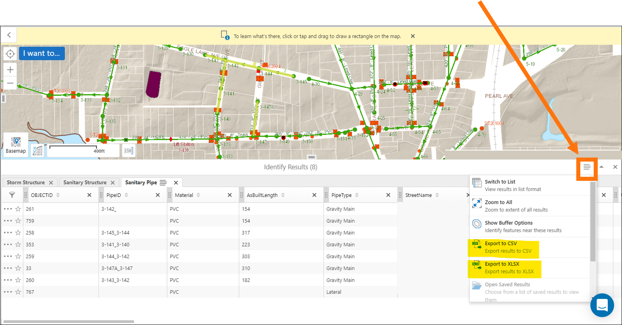
With just a few clicks in your map viewer, you can export data for use in reports, presentations, and other familiar software like Excel, PowerPoint, and ArcGIS. This data allows you to take the power of AssetAlly into your organization. Learn how to make the most of your AssetAlly data in this easy to follow tutorial.
6 Important Questions to Ask Before You Select a GIS

How AssetAlly Can Help Your Community Prep for Spring

Spring has sprung! Well, maybe not quite yet... but it’s getting closer! Winter can be a chaotic time of year for municipalities dealing with snow removal, frozen pipes, property damage from snowplows, and more. Learn how AssetAlly can help your municipality prepare for spring and get the most out of your GIS by completing sign inventories and performing inspections when cleaning infrastructure.
New Year, New Newsletter, New Events!

Welcome to our new and improved AssetAlly newsletter! Formerly distributed through our website directly, we hope you’ll look forward to receiving helpful monthly user tips, updates on new features, frequently asked questions, and other valuable info related to your GIS directly to your inbox each month. To start, here’s a few of the events we’re most looking forward to in 2020!
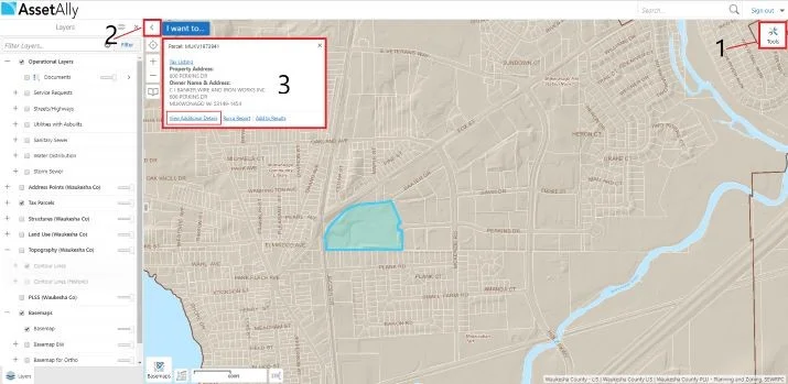
Getting Started With AssetAlly
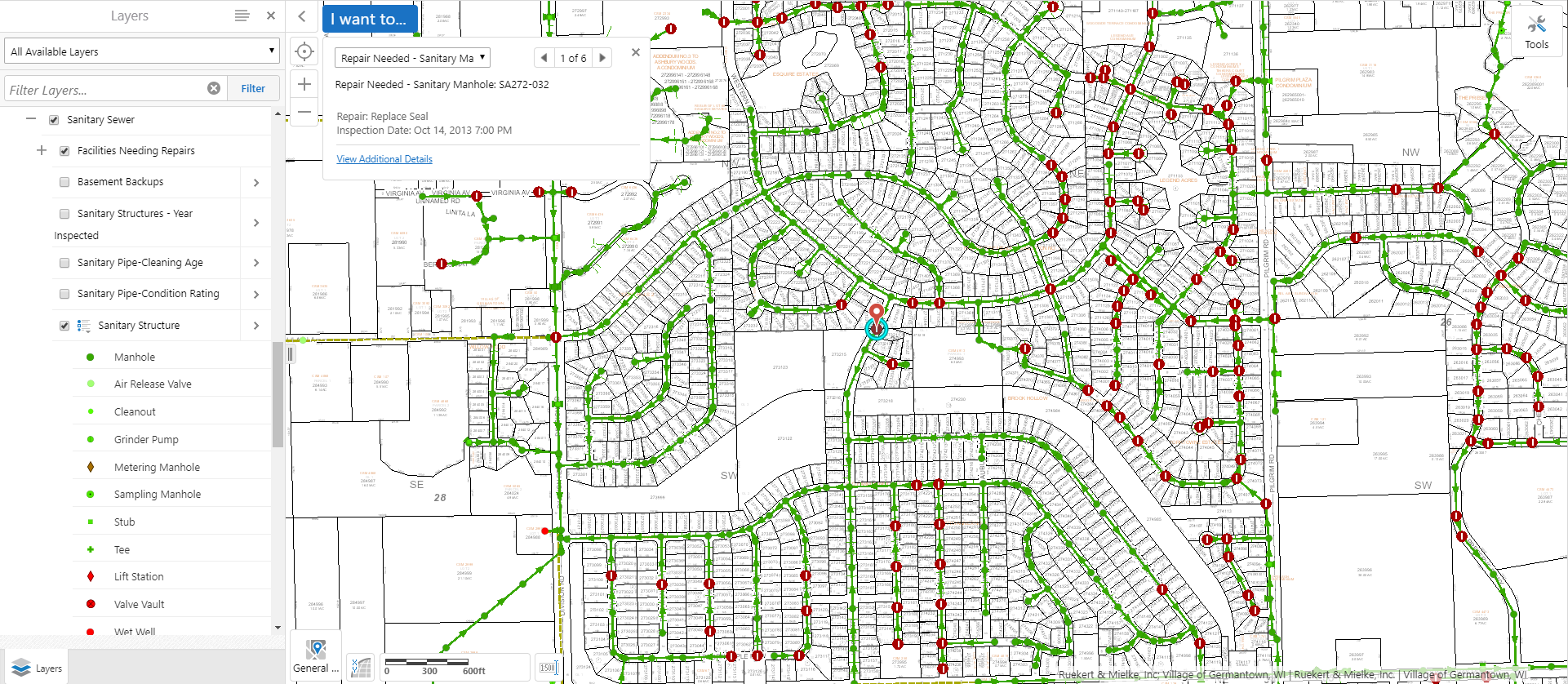
4 Ways AssetAlly Can Help Maintain Your Sanitary Sewer System

How to Jump Start Your GIS Implementation
The benefits of using a GIS to manage your community’s assets are vast, but the implementation process can often seem overwhelming, especially when there are multiple stakeholders and departments involved. Fortunately, there are steps you can take at the beginning of the set-up process to avoid unnecessary headaches and set your team up for long-term success. Here are a few of our best tips to help your municipality jump start its GIS implementation.
Streamline your Processes: The Manhole Inspection Tool

Manholes are the primary points of access to your community’s underground infrastructure. The AssetAlly Manhole Inspection Tool streamlines the inspection process, giving your team portable, digital access to previous inspection data and the ability to efficiently complete new inspections on-the-go.
Visualize Your Road Ratings Data in GIS

Every odd year, Wisconsin municipalities are required to conduct road ratings and submit their findings to the Wisconsin Department of Transportation (WisDOT). Learn how AssetAlly can help your team visualize your ratings and the evolving state of your community’s roads, making it easier to prioritize road maintenance and adjust your budget accordingly.
What’s New in the Latest Release of AssetAlly

We’re constantly exploring new ways to enhance and update AssetAlly to provide your team with the best user experience possible. AssetAlly 1.7 includes several new features, enhancements, and resolutions to your application. Releases like these are done periodically, so your application is consistently improving!
AssetAlly: Your Tool for Organization
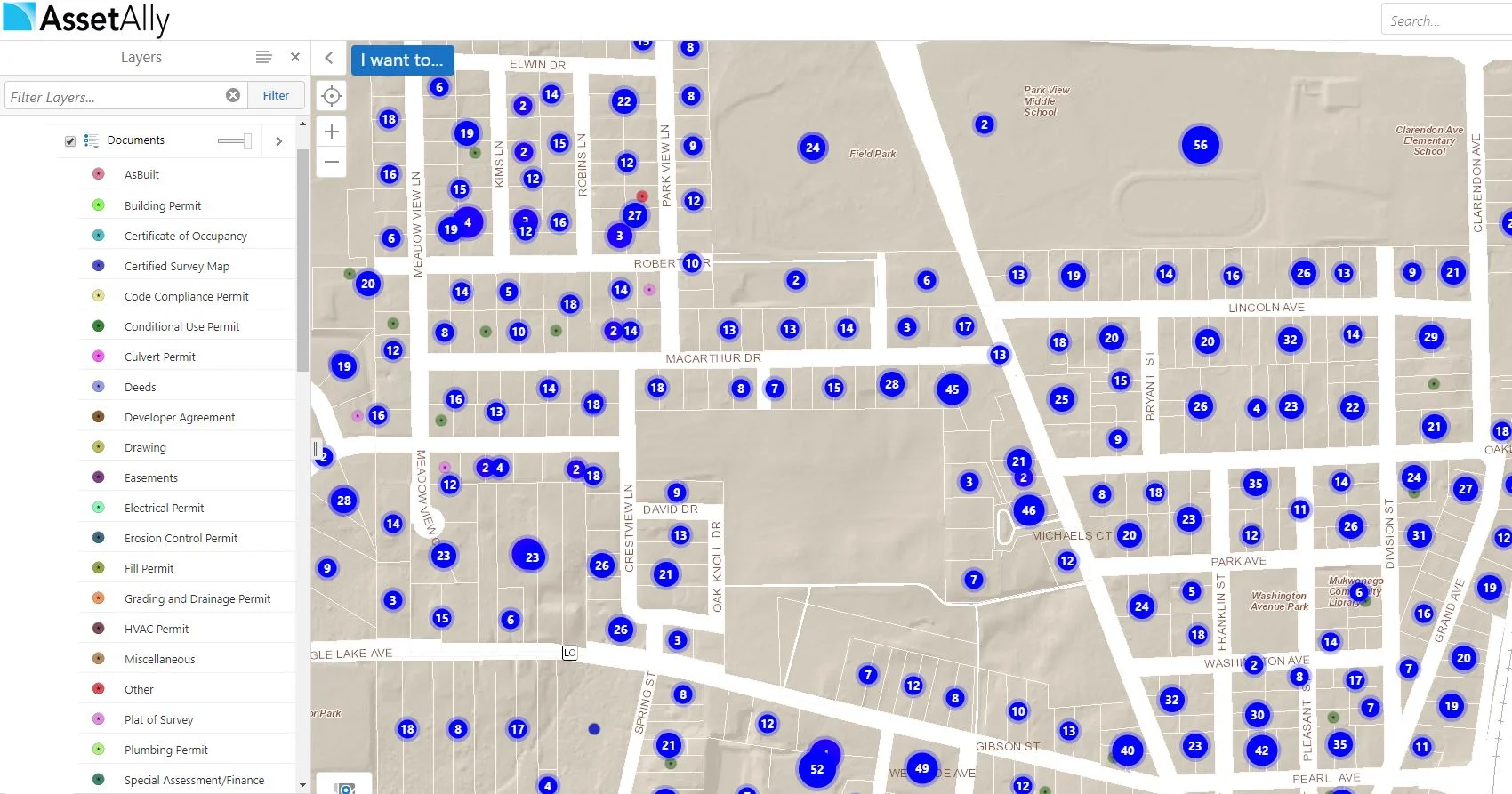
Are you looking for ways to cut down the amount of time you have to spend on administrative tasks? AssetAlly can help you maintain and organize all of your documents in a safe and convenient location. This information can be easily shared across departments, so there’s no more fetching documents for anyone!
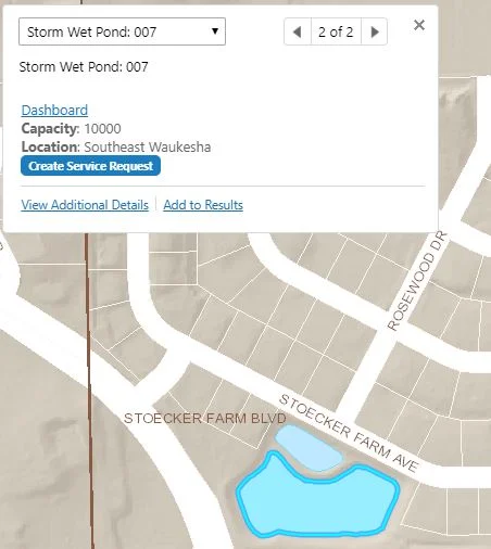
A New Approach to Storm Water Facility Inspections
Keeping Up with Forestry: The Tree Management Tool
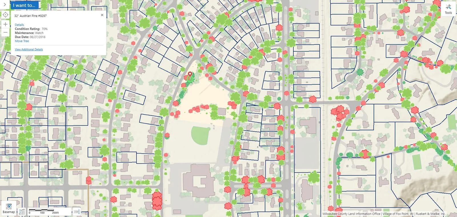
The management and maintenance of trees is essential in strengthening the quality of living in urban spaces. Optimal tree density and distribution is a vital aspect of many urban planning projects, as trees have an assortment of benefits on people and the environment. Learn how AssetAlly can assist you with managing your community's trees.