
With a few clicks from your map viewer, you can export data for use in reports, presentations, and other familiar software. This includes programs such as Excel, PowerPoint, and ArcGIS, where you can create new data products to bring the power of AssetAlly into your organization.
Exporting Data
To begin, log in to your AssetAlly portal page and navigate to the map viewer. In the left-hand side toolbar, enable the layers you want included in your data export, which can include any number of layers from parcels, sanitary, storm, and water utilities, and more.
Tabular Data
To export your assets in the tabular data format (e.g., spreadsheet), first expand your toolbar from the top-right corner of the map by clicking the Tools button.
Next, locate the Find Data section, and choose which selection method you would like to use to select data. Clicking the small drop-down arrow, you’ll see the choices include Point, Freehand, Line, Polygon, and Rectangle.
Choose the option best suited to your needs. For example, if selecting multiple adjacent assets, Rectangle may be the simplest and most useful option.
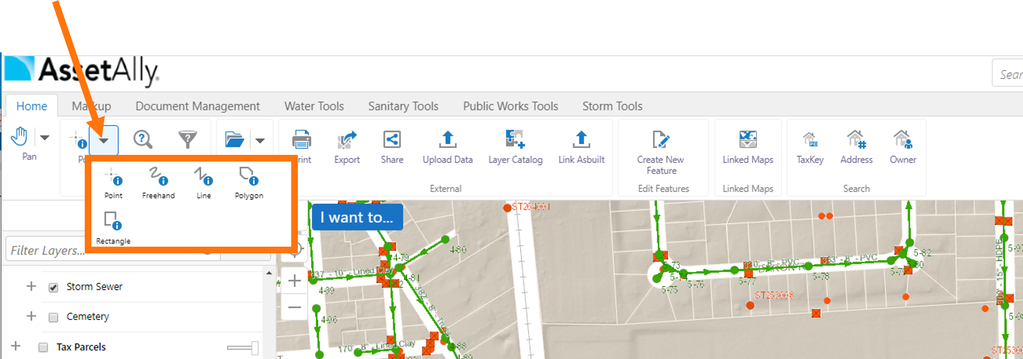
Note that if you already know that a rectangle is sufficient for your data selection, you can accomplish this same task by clicking the I want to… blue button in the top-left corner of the map, and selecting Find data on the map, which will set you up right away with the Rectangle selection tool.
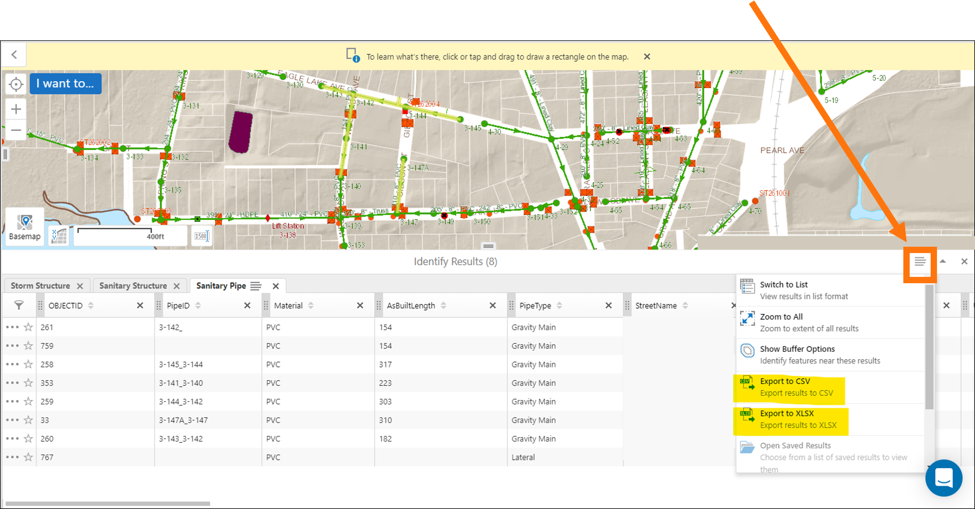
After selecting your assets, a spreadsheet will appear at the bottom the map, where you can now export the data (highlighted yellow in the image below) to a familiar format, such as a CSV (comma-separated value) file or an Excel spreadsheet (XLSX).

Note that a similar icon is available on each asset type (Storm Structure, Sanitary Structure, and Sanitary Pipe below) tab on the left-hand side of the spreadsheet, where you can export just that single layer to CSV, XLSX, or directly to a GIS-ready shapefile (SHP).
The data is now ready for you to use it in a report, a presentation, or import it into your own software: geospatial, accounting, business analytics, and more!
Image data
Another data format that you can export from the AssetAlly map viewer is an image, or raster, of the current map extent. This includes the most common image formats (PNG, BMP, JPEG, TIFF, GeoTIFF, PDF) and the option to include georeferencing data in a projection (PRJ) file and a world file, or geotagged metadata, in the case of a GeoTIFF.
First, pan and zoom around your map until you have captured the extent you would like to be contained in your exported image.
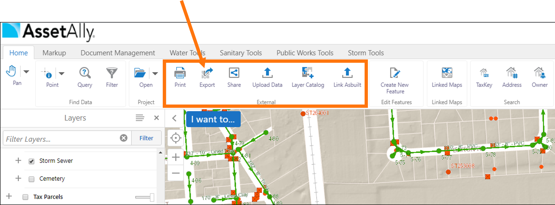
Then, from the Home tab of your toolbar, find the External section, and click on Export. Select your desired format and save your map image where it can be used for reports, presentations, or raster datasets in your next GIS project!
Learn More
If you have any questions or need additional guidance on exporting your GIS data, please contact our team today!
