

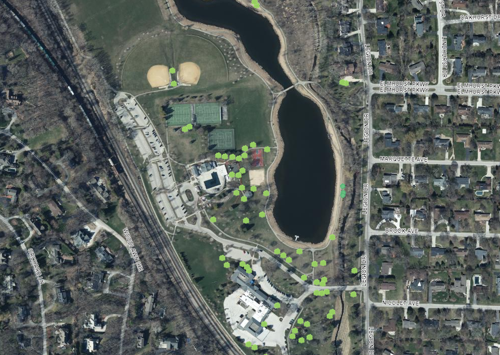
Municipalities are showing more interest in publicly sharing their GIS data, and with good reason! Learn how AssetAlly and ArcGIS Online are helping communities share important public resources and tell compelling project stories using Story Maps, public mapping applications, and Hubs.
End of Construction Season Planning GIS Cheat Sheet

Why does it always feel like the end of construction season arrives when there’s still too much to do and not enough time to get everything done? While we can’t days to your calendar, our GIS Maintenance Cheat Sheet can help you stay organized and avoid administrative headaches as you navigate this busy time of year.
Top 5 GIS Articles of 2020

As we wrap up all things 2020, the AssetAlly team is hard at work developing new ways to bring you valuable GIS content in 2021. While we plan for what’s next, we like to look back at the content you liked most over the last year. So without further ado, here are the top 5 AssetAlly articles of 2020.
CELEBRATING GIS DAY AND LOOKING FORWARD TO 2021

Sanitary Sewer Main Rehab: The Village of Hartland and AssetAlly

Meet Your New Operations Dashboards: View Progress, Goals, and Data At-a-Glance
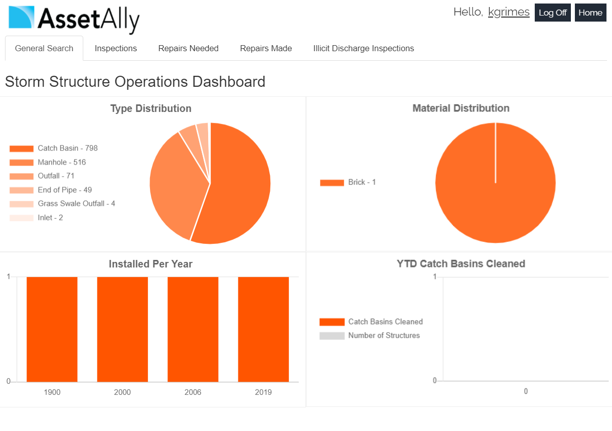
AssetAlly now includes new Operations Dashboards that give you an instant graphic overview of important community data like your team’s current workload, annual routine maintenance progress, and other essential infrastructure statistics. Learn how this new feature will help you spend less time crunching numbers and more time improving your community.
Meet the AssetAlly Development Team

AssetAlly and Esri: What Our Partnership Means to You

When it comes to selecting a GIS provider, municipalities must often choose between a tailor made solution that’s easy to navigate but offers limited capabilities, and a generic solution that may have endless, robust capabilities but is impossible for a non-GIS expert to maneuver. Learn why our partnership with ESRI gives your community the best of both worlds.
Are You Getting the Most out of Your GIS?
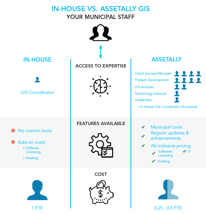
Whether you’re a new client, a new municipal employee, or long-time power user, it’s important to know what makes AssetAlly so different from other GIS providers in order to effectively maximize its benefits across all users and departments. There are so many reasons why AssetAlly stands out as the best GIS solution for municipalities, but for the sake of time, we’ll highlight our three favorite examples here.
6 Important Questions to Ask Before You Select a GIS

New Year, New Newsletter, New Events!

Welcome to our new and improved AssetAlly newsletter! Formerly distributed through our website directly, we hope you’ll look forward to receiving helpful monthly user tips, updates on new features, frequently asked questions, and other valuable info related to your GIS directly to your inbox each month. To start, here’s a few of the events we’re most looking forward to in 2020!
Getting Started With AssetAlly
As-built Upload Tool

Exporting Your Map as an Image

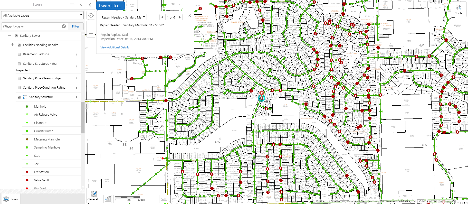
Table View vs. List View

When identifying features, you have the ability to view your data in a tabular Excel-like format without leaving your map. In this article we'll identify some sanitary structures and then demonstrate how to switch between the List and Table views available for displaying results. We'll first turn on the targeted layer--in this case, our sanitary layer--and use the rectangular identify tool to select a group of sanitary features to observe in our results window.
